


[BUYER'S GUIDE]

How to Choose a 3D Laser Scanning Company in Houston (2026)

Choose on what you will receive, not on the scanner. Ask each company for the deliverable formats, the registration report, a coverage map, how accuracy is specified, who does the modeling and where, what site access and insurance paperwork they carry, and a fee and turnaround in writing. The sections below show what a complete response looks like and what should make you look elsewhere.

[WHAT TO REQUEST]

What should a laser scanning request name?

Deliverables and formats
•  Registered point cloud in E57 (ASTM E2807) and RCP, plus the native project file if your team uses it.
•  Registration report with method and quality metrics.
•  Coverage map showing what was captured and what was not.
Accuracy
•  Accuracy by instrument class, with the project tolerance agreed to scope.
•  Manufacturer figures stated as 1σ, not as the tolerance you will get.
•  USIBD Level of Accuracy target agreed before the first scan, if your specification uses it.
Coordinates and control
•  Survey control, with local coordinates by default.
•  Tie to a published datum through a licensed surveyor when the project requires it.
Drawings and models
•  File type, version and LOD named (for example Revit 2026).
•  Deviation report as a separate line, only if the project needs model-to-point-cloud comparison.
Site access and safety
•  Access windows, escorts, safety orientation and any site credential, including TWIC where port or marine facilities apply.
•  Certificate of insurance and your prequalification platform, raised at scoping.
Data handling
•  Where the point cloud is processed and who handles it.
•  NDA signed before data moves; U.S.-only processing stated in the request if required.
[RED FLAGS]

What should make you look elsewhere?

See Pricing
COST GUIDE

No named formats

"A point cloud and drawings" with no E57, RCP or native file named.

One accuracy number

A single figure for every job, or a 1σ manufacturer figure quoted as your tolerance.

Price with no basis

A per-square-foot price with no assumptions, field date or delivery date.

Vague on modeling

No clear answer on who models and where the project is processed.

Everything included

A deviation report promised on every job at no extra scope.

Land survey claims

Presents as a land surveyor without a Texas RPLS.
[INSTRUMENTS]

Terrestrial or mobile: the instrument follows the tolerance

arrow rightarrow right
REQUEST A QUOTE
Terrestrial scanners such as the Leica RTC360 support tight-tolerance documentation; the RTC360 is manufacturer-rated under 1/8 in at 33 ft (1σ)
Mobile scanners cover large areas in less field time and are constrained to survey control to hold absolute accuracy
Ask which instrument they would use on your project, and why
Ask what tolerance they will document for your project, and in which report
Be wary of a company that owns one class of instrument and recommends it for every job
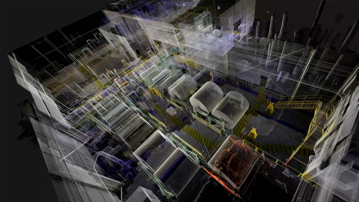
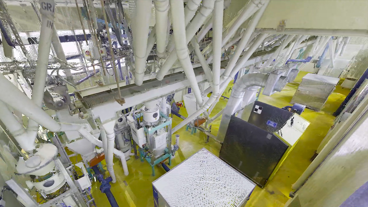
Point cloud of packaging-plant equipment captured with a 3D laser scanner

Questions to ask, and what a complete answer looks like

AskA complete answer
What will I receive?Named formats (E57, RCP/RCS or the native project file), a registration report and a coverage map
How is accuracy specified?By instrument class, with the project tolerance agreed to scope and documented
What is the figure based on?Manufacturer figures are 1σ and are stated as such
How is the scan tied to coordinates?Survey control, local coordinates by default, tie to published datums through a licensed surveyor
Who models, and where?The proposal says where the project is registered and modeled
What are the fee and turnaround?Scoped by field days and station count, with a field date and delivery date in writing
Can they work in my facility?Access windows, escorts, safety orientation and prequalification confirmed at scoping

Reference: USIBD Level of Accuracy (LOA) Specification. This guide covers documentation of existing conditions, not boundary or ALTA/NSPS surveys, which require a Texas Registered Professional Land Surveyor.

Last updated November 3, 2026.

[HOW DYNAMICJT ANSWERS]

How DynamicJT answers these questions

Fee and turnaround: $5,000 minimum, a quote within 48 hours, and field and delivery dates in the proposal
Deliverables: registered point cloud (E57, RCP, LAS, Leica LGSX), registration report and coverage map with every project
Deviation report available on request
Scan-to-CAD and scan-to-BIM scoped separately
Accuracy agreed to scope before mobilization and documented in the registration report
Site access confirmed at scoping, including prequalification requirements
3D point cloud of a packaging plant production line from laser scanning
How much does 3D laser scanning cost in Houston?
arrow up
It depends on area, congestion, scan positions, access and the deliverables. Projects with DynamicJT start at a $5,000 minimum and are scoped by field days and station count. The cost guide explains what moves the price.
How long does a scanning project take?
arrow up
Field capture is usually one mobilization. The registered point cloud follows within days; drawings and models take longer and are scoped separately.


Do I need a licensed land surveyor?
arrow up
For boundaries, easements, plats and ALTA/NSPS surveys, yes: those require a Texas Registered Professional Land Surveyor. Existing conditions documentation does not replace them, and we can coordinate with a licensed surveyor when a project needs both.
Which file formats should I request?
arrow up
E57 (ASTM E2807) is vendor-neutral and works across software. Add RCP for Autodesk workflows
and the native project file if your team uses that registration software.
Can a company scan an operating plant?
arrow up
In most cases, yes. Scanning is non-contact and quiet, so units typically stay in service. Capture is planned around access windows, escorts and site safety requirements.


What should I ask about accuracy?
arrow up
Ask how it is specified by instrument class, what tolerance is documented for your project, and whether the figure quoted is a manufacturer 1σ value.
[GET IN TOUCH]

Send us the scope

Project address and site type, area, formats and software versions, access windows and your deadline. We reply with a fee and turnaround within 48 hours.
info@dynamicjt.com
+1 (832) 746-1497
1120 NASA Parkway, Suite 220D Houston, TX. 77058
Houston-Based Field Team
Point cloud flythrough animation of a scanned industrial building
Thank you! Your submission has been received!
Oops! Something went wrong while submitting the form.